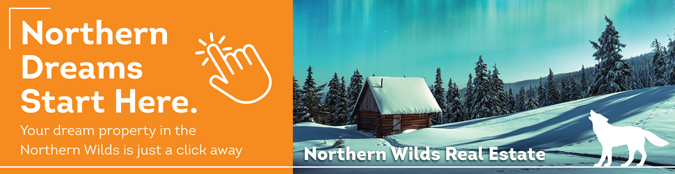
Sheer cliffs tower above sparkling waves. Smooth domes swell up before you on a portage. Craggy points reach out to caress the water. Oddly-shaped boulders loom in the depths or stand wet-footed in the shallows. They cradle the lakes, frame the vistas, and create stairs, rooms, and seats in your campsite home. Rocks are an integral part of any experience in my beloved Boundary Waters Canoe Area Wilderness in northeastern Minnesota.
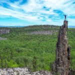
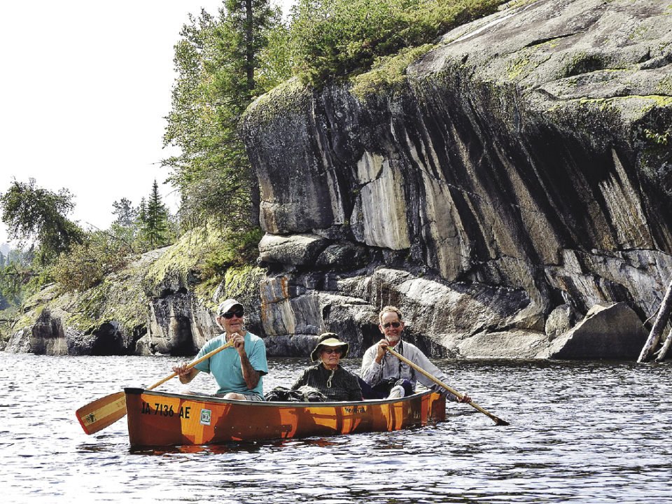
Good campsites are determined by the quality of rock outcrop they provide for an afternoon nap. Popular lakes are defined by the height of the mineral-streaked cliffs that waves crash against, or the placement of islands in strategic photo locations. Portages are remembered for the abundance of ankle-twisting rocks, or the lack of solid footing around marshy beaver ponds.
The rocks of the Boundary Waters are appreciated—and cursed—by travelers, but understood by few. Knowing a little bit about the bedrock of its history can make the wilderness an even more awe-inspiring place.
The tangible geology of the Boundary Waters begins about 2.7 billion years ago. The rocks of this era are part of the Canadian Shield, the heart of the continent. This “craton” is the base on which the rest of North America was formed. In the Boundary Waters, the shield is composed of three types of rocks: metamorphosed volcanic rocks, metasedimentary rocks, and granitic rocks.
Many wilderness paddlers pass through the town of Ely on their way into the lake country. If you wind through the back streets toward the intersection of 13th Avenue and Main Street, you may find yourself face-to-face with a large and lumpy boulder known as the Pillow Rocks. This metamorphosed volcanic rock is one of the oldest rocks on the continent.
Just as lakes fill depressions in the north country today, 2.7 billion years ago inland seas collected primeval runoff. Rifts, or spreading cracks, developed on the seafloor and released basaltic lava—like the oozing black rivers in Hawaii—from the Earth’s molten mantle into the marine depths. (Today this process still occurs along the Mid-Atlantic Ridge.)
Lava that erupted directly into the bottom of that ancient ocean—an ocean at least 1,000 meters deep—cooled into characteristic structures called pillows. As the hot lava rose into cold water, it formed blobs reminiscent of a 1960s lava lamp. The pillows piled up on each other, up to 5,000 meters thick.
If you don’t go through Ely on your way into the Boundary Waters, chances are you’ll wind your way up the Gunflint Trail out of Grand Marais. The numerous low islands and serpentine shoreline of Saganaga Lake at the end of the Gunflint Trail give even the best navigators a challenge.
The bedrock at Saganaga Lake was once giant plumes of molten rock that rose slowly up through the Earth’s mantle, like bubbles in a huge pot of simmering sauce. These batholiths, as geologists call them, changed composition as they rose and cooled beneath the continent. Originally the magma would have had a similar composition to the basalt that formed the pillow lavas. Over time, minerals rich in magnesium and iron, with higher melting temperatures, crystallized out, and left behind mostly silica, oxygen, and aluminum—the main components of granite.
Although the granite cooled and hardened before it reached the Earth’s surface, subsequent erosion removed the rocks that covered it, eventually exposing it to the light of day. The massive, relatively homogeneous mass of granite didn’t have weak spots for erosion to get its foot in the door, and so paddlers now glide past rounded islands and oddly-shaped bays. The granite that forms Saganaga Lake is just one example. Underneath canoe country’s most island-rich lakes, from Vermillion to Basswood to Sea Gull, you’ll find a similar story.
In general, your most spectacular vistas, and most backbreaking portages, occur in areas where different rock types come together. The far northeastern section of the Boundary Waters, especially Clearwater, Duncan and Rose Lakes, is a grand example. Here, the soft, metasedimentary Rove Formation is interrupted by the Logan Intrusions. Long, linear lakes have been eroded from Rove, while volcanic rocks that were once hot and molten now rise majestically into the sky.
In contrast, other elongated lakes, especially those aligned north/south, form along faults where fractures in the rock gave erosive water and ice an easy access point. The Vermillion Fault near Basswood Lake is the largest in the area. Anytime a stream course suddenly runs stick-straight, or a cliff juts like a wall above the water, you’ve likely found a place where deep tectonic stress caused the bedrock to break.
Of course, bedrock is only part of the story. Huge masses of moving ice, up to two miles thick, advanced southward from the Laurentide Ice Sheet in Canada many times over hundreds of thousands of years. In the Boundary Waters region, these glaciers possessed incredible erosive power and carved their way across the landscape. Many of the north or northeast trending lakes were gouged out beneath ponderous glaciers.
As the ice moved, it picked up chunks of rocks from one area, carried them a while, and then deposited them again. Called “glacial erratics,” these boulders are the ones you find perched in odd places.
Next time you climb a spectacular vista, lie out for a nap on a gently sloping rock, or paddle through an island-speckled lake on a foggy morning; take a moment to think about the billions of years and geologic processes that went into creating the beauty that surrounds you.