By Ada Igoe
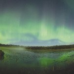
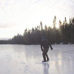
The North Country is notoriously hard to traverse. Thick undergrowth often keeps even the most intrepid hiker from straying far from the beaten path. Happily, during the winter months, wide hiking expanses open up when area lakes freeze over. Suddenly, hikers (especially those equipped with snowshoes) can head just about anywhere they can imagine.
The beauty of winter hikes and snowshoe treks is the woods’ open invitation to break your own path through the snow. Because the North Country is such a big place, we’ve compiled a list of some of our favorite winter tromps. A word of caution, some of the suggested hikes require traversing frozen lakes and rivers. Safe ice conditions can’t be guaranteed; please be a vigilant hiker.
Moss to Duncan to Partridge
During the winter, it’s easy to transform your favorite day-trip canoe route into a favorite day hike; just substitute snowshoes for canoes. You can put this method into practice when you snowshoe across Moss, Duncan, and Partridge Lakes, located approximately 30 miles up the Gunflint Trail outside of Grand Marais.
You’ll hike through groves of centuries-old cedar trees and towering white pines and pass a rippling brook along the Partridge Lake portage. There is a small parking area off Hungry Jack Lake Road, kitty-corner from the canoe put-in on Hungry Jack Lake. Hike the Hungry Jack/Moss portage into Moss Lake, then portage into Duncan Lake, and head west into Partridge Lake. Round trip is approximately five miles long and adventurous hikers (with two cars) can make this a loop by hiking out on the South Lake Trail.
LeVeaux Mountain
Oberg Mountain is a well-known hiking destination on the North Shore, located between Tofte and Lutsen. Oberg’s twin, LeVeaux Mountain—which shares a parking lot on Forest Road 336, the Onion River Road—gets a little less love. LeVeaux Mountains is a moderate 3.2-mile loop that connects to the Superior Hiking Trail. The trail features high cliffs, deep woods, and views of Lake Superior.
South Kawishiwi River
The South Kawishiwi River is another canoe route easily transformed into a winter snowshoe trail. To access, park at the South Kawishiwi canoe put-in, approximately 10 miles southeast of Ely off of Hwy. 1 on Forest Road 181. A 140-rod portage takes you from parking lot to the river. From there you’ll step into a winter wonderland. Hike up the river through the snow-covered forest into the Boundary Waters Canoe Area Wilderness.
Tettegouche State Park
With ongoing construction of a new visitor center, the park may appear to be in bit of disarray, but hikers are still welcome at Tettegouche this winter. Parking is available in a temporary parking lot located southwest of the Baptism River Bridge on Hwy 61.
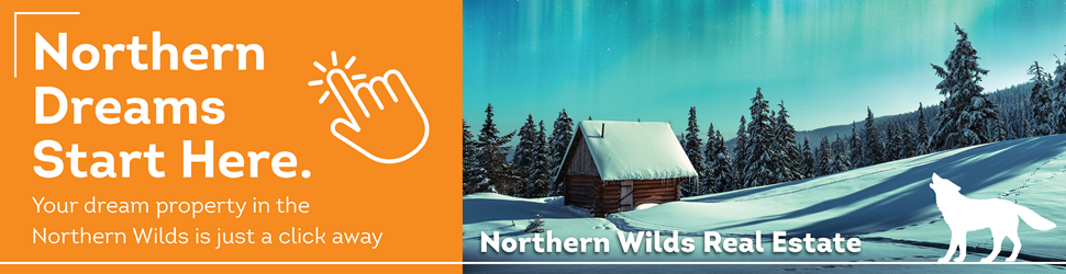
Many trails offer spectacular views of Lake Superior and winter storms can turn the shoreline rocks and trees into an ice sculpture exhibit. A favorite destination is Shovel Point, a rock cliff that juts out into Lake Superior.
Mountain Portage Trail
Follow in the footsteps of the Voyageurs at Kakabeka Falls Provincial Park. The Voyageurs used this easy 1.3-kilometer path to skirt around the waterfall called the “Niagara of the North.” The trails offer benches, viewing platforms and interpretative displays. While not exactly off the beaten path, the trails at Kakabeka are well suited for young hikers with short legs. The park is approximately 30 kilometers west of Thunder Bay.
Hartley Nature Center
At Hartley Nature Center, beautiful hikes are hidden right in middle of Duluth. Located at 3001 Woodland Avenue, Hartley has more than 10 miles of well-marked hiking trails. The trails’ difficulty varies drastically and the Superior Hiking Trail runs through t,he park, allowing you to hike for miles and miles, if you wish. Snowshoes are available to rent at the Nature Center.
Kabeyun Trail
Part of the Sleeping Giant Provincial Park hiking network, located east of Thunder Bay near Pass Lake, the 40-kilometer Kabeyun Trail can be accessed from the Thunder Bay Lookout or Highway 587. The trail takes you by Lake Superior and around the Sleeping Giant. A favorite destination located off a spur trail of the Kabeyun Trail is the Sea Lion, a rock arch in Lake Superior that once resembled a sea lion. (The formation’s “head” fell off years ago.) The Sea Lion trail is located just past Lake Mary Louise Campground off of Hwy 587.