Question:
What happens when four geezers, aged 54-65, attempt to hike the third most difficult trail in Ontario?
Answer:
Quite a bit of pain, and a lot of gain.
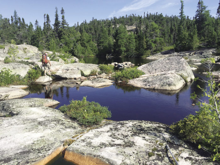
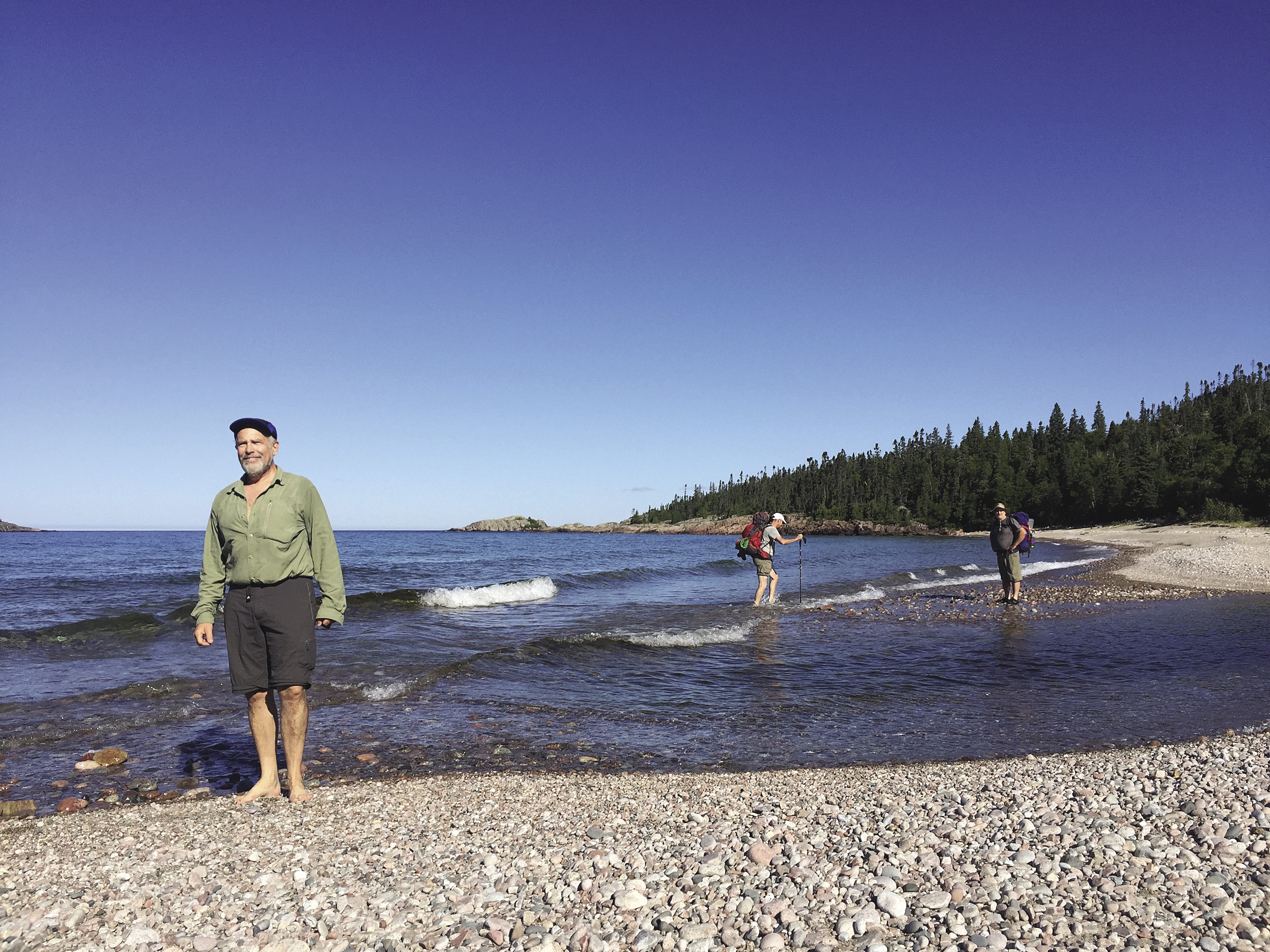
In early August, my wife Kathy McClure, friends Kevin Wallace and Phil Deering, and I boarded Keith McCuaig’s 30-foot custom built water taxi for a ride to the end of the Coastal Hiking Trail at Pukaskwa (pronounced Puck-a-saw) National Park in Ontario. For the next five days, this trail would test us physically, as it wound through the boreal forest, over steep inclines and gravel shorelines. The path also led to amazing vistas and the most idyllic waterfront campsites one could imagine.
Pukaskwa, located 320 kilometers east of Thunder Bay, is the only wilderness national park in Ontario, Canada. It contains 1,878 square kilometers of boreal forest and shoreline. All areas but the visitor’s center at Hattie’s Cove are accessible only by foot, water taxi or kayak.
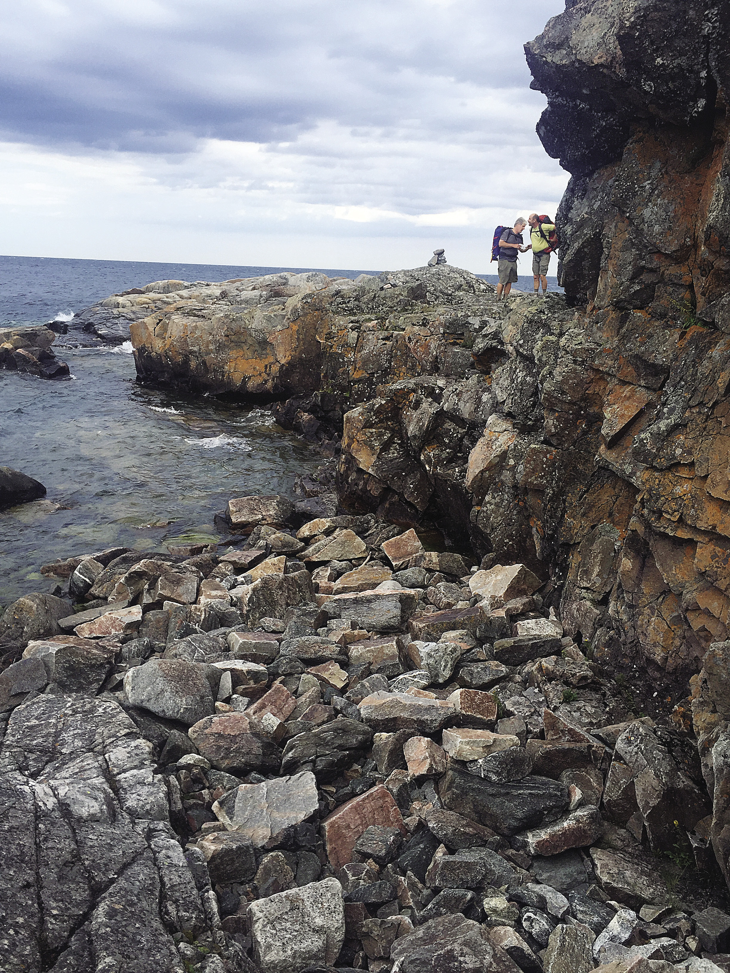
After a bone-jarring two-hour ride, our captain lowered the front gate and we disembarked at North Swallow Harbour campground; the end of the trail. A father and daughter were waiting for a ride back. As we settled into the campsite, the father, who appeared quite fit and capable, complained vehemently about the difficulty of the trail—the steep, exposed path along rocky faces, the lack of a clear trail, the river crossings, the boulders, and the energy-sucking slogs along the gravel shoreline.
We would find that, though his complaints may have been exaggerated, the challenges were real. By the time the sun set on our first day of hiking, aches, pains and an injury required our attention. Kevin, the youngest among us, set out at a rapid pace until his quads began to tighten, presumably from racing up the steep, boulder-strewn inclines. Evening massages and a slower pace enabled him to continue until he acclimated to the conditions.
Phil, the elder statesman in the group and also the most experienced backpacker, avoided injury throughout the trip. On the first day, though, he had an incident that could have been more serious. While crossing a stream on a log, Phil slipped. Rather than falling into the stream, he straddled the log, a scene that might have been comical were it not for age and geography. However, the only injury was his pride as he pushed himself along the log with his feet dangling from either side.
That evening at our idyllic beachfront campsite, Kathy incurred the most serious injury of the trip. After a refreshing swim, she settled into some beach-side yoga, only to fall from a handstand onto a stick-sharpened log. The scrape to her knee proved less troublesome than the rib injury, which plagued her for weeks afterward.
I was not exempt from the injury bug. After a second day of boulder hopping, the farthest joint of my second toe began to swell. It throbbed painfully all night and, though it would loosen up during the hike, bothered me for the remainder of the trip. I did find, though, that dipping it in the cool Lake Superior waters was the most effective therapy.
The difficulties and dangers of the trail were easily worth the price, because the wonders of the trail far surpassed our expectations. Long slogs up severe ravines and steep inclines led to stunning vistas of islands and harbors along the pristine shoreline. Trudges around marshes led to inland lakes glittering in the midday sun.
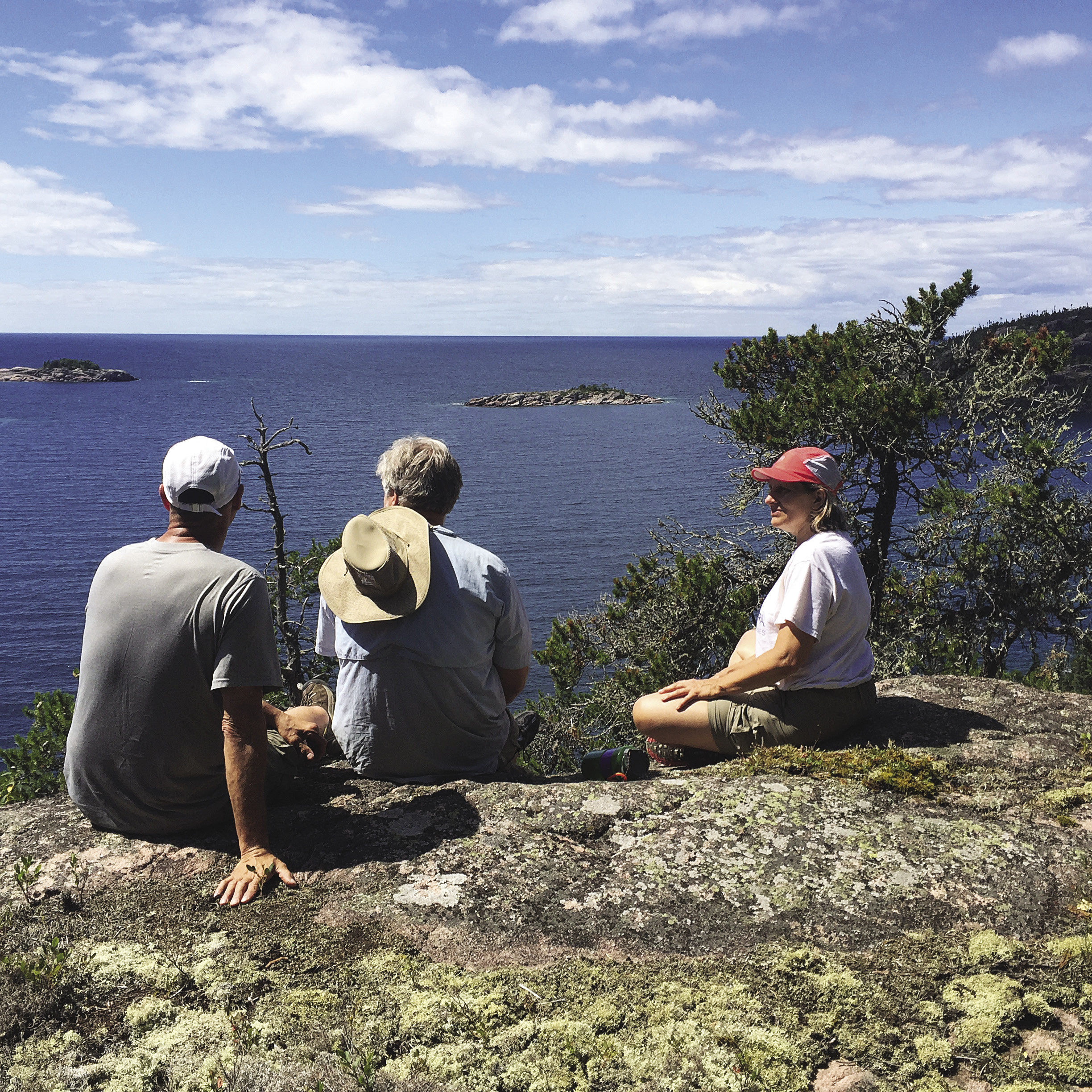
Without question, though, the jewels of the trip were the beachfront campsites from Morrison Harbour to North Swallow Harbour, approximately the outer 35 kilometers of the trail. Here, sandy beaches were tucked into protected alcoves rimmed with islands. Tall cliffs and wooded promontories framed one’s surroundings. The clear water glistened and lapped along the sandy shore.
Arrival at such a sight necessitated a dip into the cooling waters, not long after our packs hit the ground. Refreshed, we explored and set up camp. This was usually followed by another swim. After dinner, a few sips of whiskey took the edge off our aches and pains as we watched the sun arc along the horizon. At Fish Harbour we speculated that the sun might disappear precisely in a narrow gap between two islands. We watched mesmerized as the sun obliged, leaving crimson streaks along the lingering clouds.
The Coastal Hiking Trail is not to be taken lightly. In 2016, 496 people hiked all or part of the trail. There were three incidents requiring a visitor safety response. Based on our experience, a successful trip is achievable to those who are reasonably fit and have over-night hiking experience. For those who are willing to put up with a little blood, sweat and tears for a phenomenal camping experience, Pukaskwa National Park should be on their bucket list.
Day trips are also very popular at the park. There are trails ranging in length from 1.5-2.6 kilometers. More ambitious day hikers can trek the 18-kilometer round-trip to the White River suspension bridge. On May 15, a new trail will open. Mdaabii Miikna, which means “go to the shore trail” in Anishinaabe, will connect to new areas of coastline and contain nine campsites. At 24 kilometers, it can be traversed in a weekend.
For more info on Pukaskwa National Park, click here.