Cook County boasts a rare combination: the highest and the lowest points in Minnesota. Both are accessible by day hike.
The highest point in Minnesota is Eagle Mountain at 2,301 feet, according to the U.S. Forest Service. Minnesota’s lowest point is the shore of Lake Superior at about 600 feet above sea level.
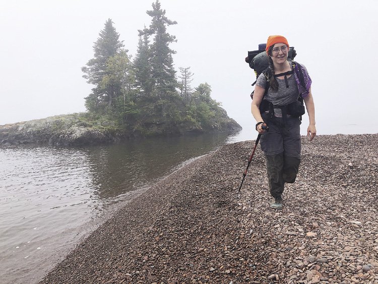
Eagle Mountain
7 MILES • 4-5 HOURS • INTERMEDIATE
WWW.FS.USDA.GOV
This granite peak is part of a large rock formation known as the Duluth Complex in the Misquah Hills, according to the U.S. Forest service, and is located within the Boundary Waters Canoe Area Wilderness.
The hike to the summit is an out-and-back hike which runs 3.5 miles to the summit. “You will gradually climb for the first 2.5 to 3 miles,” says the U.S. Forest Service “Eagle Mountain/Brule Lake Trails” pamphlet, available at ranger stations and online.
“For the last half mile, the trail is steeper and rocky. Along the flat ridge-top are excellent vistas,” the pamphlet reads.
The official high point is marked by a brass survey disk on the west side of the ridge. As this hike enters into the BWCAW, a free self-issue permit is required and can be found at the trailhead kiosk.
Driving directions: From Highway 61, turn north on Caribou Trail (Cty. Rd. 4) just north of Lutsen. Follow Caribou Trail until it ends at Forest Road 170 and turn right. Follow FR 170 for 3.5 miles to the Eagle Mountain trailhead parking lot.
Things to know: This is a wilderness trail, which means the trail tread will be more rugged and less maintained than other trails. Most cell phones will not receive a signal inside the BWCAW. Sturdy footwear with good grip and trekking poles recommended. This short hike would also make a great overnight backpacking trip in the BWCAW as there are two USFS campsites on Whale Lake at the base of the mountain. An overnight permit would be required to camp on Whale Lake.
Suggested map: Fisher map F-6; McKenzie maps No. 3 or 21.
Superior Hiking Trail: The Lakewalk
9.4 MILES • 5-6 HOURS • INTERMEDIATE
SUPERIORHIKING.ORG
This 1.4 mile stretch of the Superior Hiking Trail runs on the beach of Lake Superior through the cobble. “This is the only part of the SHT on Lake Superior except Duluth’s Lakewalk,” in Canal Park, according to the Eighth Edition of the Guide to the Superior Hiking Trail.
“Notice the different surge levels up the beach from storms and winds,” the guide recommends. This stretch of trail also offers good spring birding, bog areas, and crosses rock outcroppings that reach out into Lake Superior.
There is no trailhead at the Lakewalk, so a short hike down to the lake must also be done. The closest trailhead to Lakewalk is the Kadunce River Wayside. Follow the .7-mile spur trail up to the Superior Hiking Trail, head right or north along the Kadunce River another 2.5 miles to the western end of the Lakewalk. The hike down to Lake Superior is beautiful, following the gorgeous gorge of the Kadunce River, then passing through birch and fir forests, an expansive field known as “Blueberry Overlook” with epic views of Lake Superior.
Driving directions: From Grand Marais, travel north on Highway 61 nine miles to the Kadunce River Wayside, which is located on the left side of the highway.
Things to know: From Kadunce River Wayside, the trail will climb about 50 feet before dropping 350 feet in elevation, so the trip back will be harder. A short stretch of the Lakewalk is currently under water due to the record high water level of Lake Superior, according to the Superior Hiking Trail Association’s Trail Conditions web page. Two options exist: Walking in the water until it is possible to get back up on the beach, and the trail association advises caution if attempted; Detour around the flooded area with a short road-walk along Highway 61, which has wide shoulders. There are several unofficial roads that cut back down to the beach that hikers can use to rejoin the trail.
Suggested map: SHTA Map 6 Woods Creek to Canadian Border.
Sugarloaf Cove: Nature Center
1 MILE • 1-2 HOURS • EASY
SUGARLOAFNORTHSHORE.ORG
A little further south in Lake County, the North Shore Stewardship Association offers a 1-mile interpretive trail at its Sugarloaf Cove Nature Center, and about half of the trail runs directly along the shore of Lake Superior.
“The trail winds through forest and over 1.1-billion-year-old rocks,” according to the association’s website.
A portion of Sugarloaf Cove is a State Scientific and Nature Area, in which pets are not allowed. The SNA is marked on the association’s trail guide, which also includes information about the geology, ecology and human history of the cove. In mid-summer, this hike offers summer wildflowers as well as a trip down to the lake across ancient basalt lava flows. The trail map and guide can be found at the association’s website.
Driving directions: From Schroeder, travel 5.5 miles south on Highway 61. The turn off for Sugarloaf Cove will be on the left.
Things to know: Due to the Covid-19 pandemic, the visitor’s center building is closed until further notice. Parking is free to members, and you can become a member on the association’s website. For all other visitors, there is a $5 parking fee.
Suggested map: The Sugarloaf Cove Trail Guide provided for free on the association’s website.