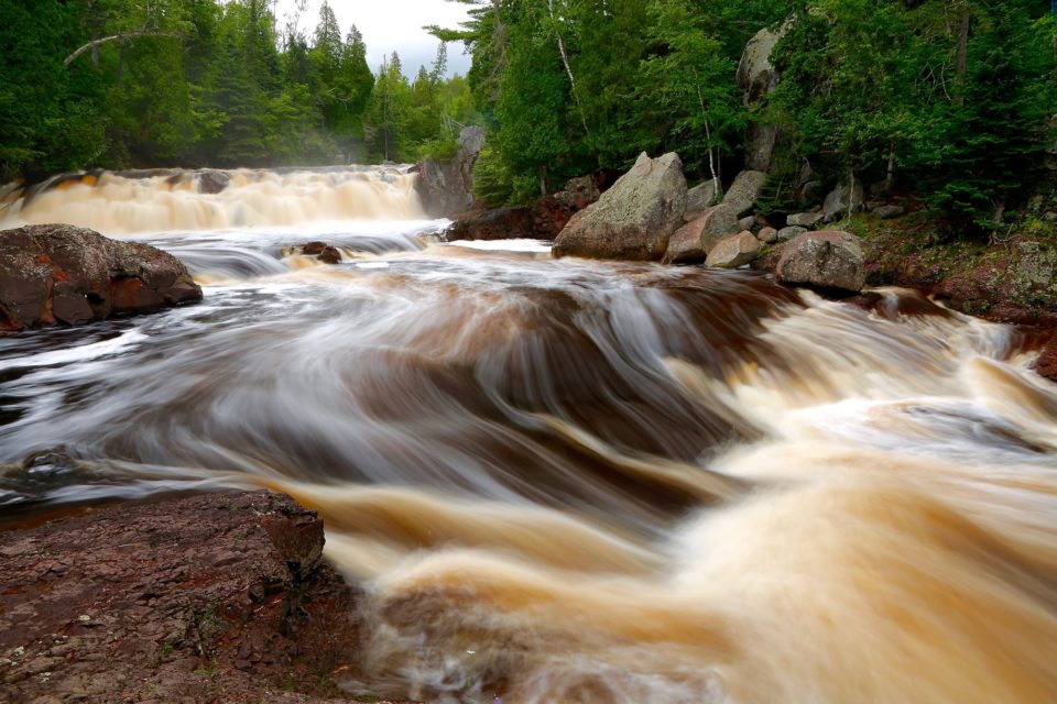
Soon the rivers of the north will be rowdy with April showers and the melt of February blizzards. Spring is prime waterfall-watching season. And who doesn’t love waterfalls? The water pounding white into a canyon gorge, the steady roar, the feathery kiss of mist on your face, the jostle of the crowd… Here is the scoop on 10 Northeastern Minnesota waterfalls you can visit on the north shore of Lake Superior
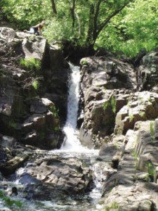
1. Tischer Creek Falls
Congdon Park, Duluth, MN
The fairytale-like environs surrounding Congdon Park’s five waterfalls provide an intimate waterfall experience, which you‘ll discover as you descend into the red chasm.
Hike Difficulty: Moderate
Trail Quality: Poor to Good
Distance Round Trip: 1.5 miles
Directions: From London Road, turn onto 32nd Avenue East (just before Glensheen Mansion), which runs into Congdon Park Drive. Follow this across Superior Street. Congdon Park is to your right.
2. Fifth Falls
Gooseberry Falls State Park,
Two Harbors, MN
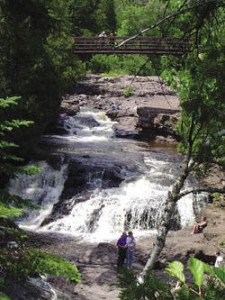
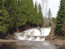
Enjoy the overlook of the waterfalls cascading over chunks of basalt through a narrow gorge pocketed with fern-lined grottos and draped in cedars. Few people visit Fifth Falls compared with others at Gooseberry.
Hike Difficulty: Moderate to Strenuous
Trail Quality: Poor to Good
Distance Round Trip: 1.8 miles
Directions: Begin at Gooseberry’s Upper Falls. Follow the trail .7 miles upstream along the west side of the river. Fifth Falls is just above the second bridge.
3. Waterfalls of the
Split Rock River
Split Rock Lighthouse State Park,
Two Harbors, MN
We counted nine major falls along 1.3 miles of this impressive stretch of northern river. Some falls are only visible from high above the river, so spring—before the trees leaf out—is the perfect time for viewing.
Hike Difficulty: Moderate to Strenuous
Trail Quality: Good to Poor
Distance Round Trip: 1 mile to West Branch Split Rock River Falls, 4.1 miles to final falls
Directions: The trailhead for the Split Rock River is on Highway 61, 2.5 miles west of Split Rock Lighthouse State Park entrance.
4. Beaver Falls
Beaver Bay, MN
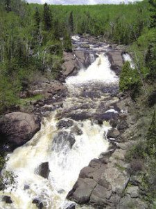
A walkway along the Highway 61 bridge provides a panoramic, eagle’s-eye view of this mammoth series of four misty torrents running over a course of about 300 feet.
Hike Difficulty: Easy
Trail Quality: Good
Distance Round Trip: < 0.1 miles to Bridge
Directions: The Beaver River flows on the east edge of the town of Beaver Bay. There are several places to park, including a dirt lot at the intersection of Lax Lake Road and Highway 61, just west of the bridge.
5. Glen Avon Falls
Beaver Bay, MN
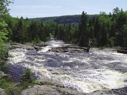
The Beaver River saunters along to this juncture, widening in a climactic drop over 100 tumbling yards. The vista is postcard-ready, set in a broad valley with a distant emerald ridge.
Hike Difficulty: Easy
Trail Quality: Good
Distance Round Trip: < 0.1 miles
Directions: Just west of the Beaver River bridge on Highway 61, take Lax Lake Road (CR 4) north 1.6 miles and turn left on CR 3. Follow CR 3 for 1.2 miles, where you will see a narrow, red dirt road heading left toward the river.
6. The Cascades
of the Baptism River
Tettegouche State Park,
Silver Bay, MN
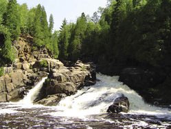
The High Falls gets all the attention at Tettegouche, but we prefer The Cascades. The river drops 12 feet, like a natural waterslide, gliding around a corner and over a large slanting rock. Sitting at water level provides an inspiring view and the rushing whitewater drowns out every other sound.
Hike Difficulty: Moderate
Trail Quality: Good
Distance Round Trip: 1.8 miles
Directions: Park in the visitor center lot and walk on the road towards the river. On the left, you’ll see a sign reading “Brook Trout Regulations.” This is where the trail to The Cascades begins.
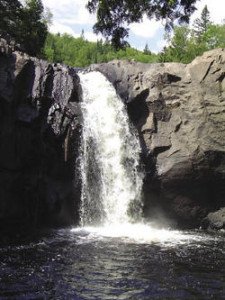
7. Illgen Falls
Tettegouche State Park,
near Silver Bay, MN
An uncomplicated yet impressive falls, Illgen Falls, from the top, appears taller than it actually is, as the narrow cascade jettisons over a large rock ledge to a pool about 35 feet below.
Hike Difficulty: Easy
Trail Quality: Good
Distance Round Trip: 0.3 miles
Directions to the Trailhead: From Highway 61, take Highway 1 toward Finland, 1.6 miles, and park on the gravel pull-off on the left side of the road. Nearby, there is a sign that says “Illgen Falls, Devil’s Rock” at the head of the short gravel path.
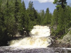
8. The Cascades
of the Manitou River
Crosby-Manitou State Park, Finland, MN
This waterfall is magnificent in its power, especially in the spring for beauty. You will likely encounter few people, though you may find evidence of moose or bear.
Hike Difficulty: Strenuous
Trail Quality: Poor
Distance Round Trip: 2.3 miles
Directions to the Trailhead: From Highway 61, head 6.5 miles up Highway 1 to where it intersects CR 7 in Finland. Turn right on CR 7 and continue 7.5 miles to the park entrance. From the parking area, take the Middle Trail to the West Manitou River Trail. Go left to The Cascades.
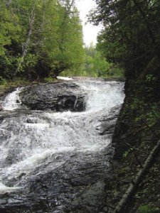
9. Hidden Falls
Cascade River State Park,
near Lutsen, MN
Who can resist a place called “Hidden Falls”—a run of several hundred feet flowing over four terraces beneath a cathedral-like canopy of cedar?
Hike Difficulty: Easy
Trail Quality: Fair
Distance Round Trip: 1.4 miles
Directions: Head northeast off of Highway 61 on CR 7, near the east end of Cascade River State Park. Go 1.9 miles up CR 7 to CR 44 and left (west) .5 miles on CR 44 to Highway 45. Turn left on 45 and proceed 2.6 miles, where there is a pull-off and parking area to the right, just before the bridge that crosses the Cascade River.
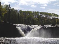
10. Lower Middle Falls
Grand Portage State Park
in Grand Portage or Pigeon River,
Provincial Park in Canada
Lower Middle Falls, just down river from Upper Middle Falls, is framed by towering evergreens and aspen, the water forming a vee of water crashing head-on, producing mist that rises to the tops of the trees.
From U.S. side
Trail Quality: Poor
Distance Round Trip: 4.4 miles from parking lot
Directions: Just before the border, on Highway 61, turn left into Grand Portage State Park. The trail begins at the parking lot.
From Canadian side
Hike Difficulty: Easy
Trail Quality: Fair
Distance Round Trip: Can see from road
Directions: After crossing the border, continue north on 61 for 1.1 miles. Turn left on Highway 593. 0.4 miles. Park along the road.
Order ‘Waterfalls of Minnesota’s North Shore & More‘
From highway waysides to invigorating day-hikes, Waterfalls of Minnesota’s North Shore And More offers waterfall experiences for everyone who enjoys the splashing splendor of Lake Superior’s tributary river and streams.
For more Northeast Minnesota Waterfalls,
check out these links:
Caribou River Falls: Hiking to a Frozen Waterfall in Minnesota


