In the days when Canada and the United States were busy building their empire through ports such as Chicago, Duluth, and the Lakehead (Thunder Bay), the journey was not always easy. It wasn’t until 1855 that commerce started to pick up with the opening of the Soo Locks. Located between Lake Huron and Lake Superior, Sault Ste. Marie offered steamship and sailing traffic a gateway to added ports.
Superior Shoal, Isle Royale, Passage Island, and Caribou Island offered obstacles to navigate around if heading to the northwest and the port of Thunder Bay. Just after Confederation in 1873, the Canadian government built two new lighthouses on Michipicoten Island and Point Porphyry to partly address this. These lights would provide a bearing to continue the trip towards the former towns of Fort William and Port Arthur (Lakehead).
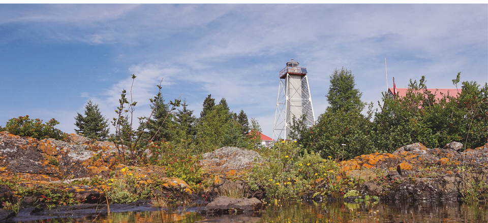
Point Porphyry, located about 25 miles east of Thunder Bay on Canada’s North Shore, was the first in the area to provide an aid to navigation. Situated on the eastern side of Black Bay, the lighthouse helped passenger steamships find their way to Silver Islet or to Nipigon Bay.
In a chart created in 1874 by Admiral Bayfield R.N., you can clearly see the route these steamships would have taken. These steamships often took men to work the mines or immigrants westward to plant the wheat fields.
Point Porphyry is a magical place because of its beautiful location. The lighthouse was built upon the magma of the mid-continental rift created 1.1 billion years ago, with dykes and pillows of basalt seen just under the water. These reefs around the island have snarled up a few vessels in their time and situated a few miles to the north, you can see three extinct volcanoes.
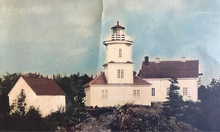
Not only is the geology of this island dynamic, but the arctic-alpine disjunct and the twisted and matted boreal forest is of interest. Upon commissioning of the lighthouse on July 1, 1873, Donald Ross took on the duty of providing service to mariners. Steam and sailing ships passing the area would toot their horn or ring their bell for the keeper to acknowledge and register in their lighthouse logbook.
Operating the light was a life of isolation but also a great opportunity to be independent while living off the land. Fishing in the area had ample rewards, with the island becoming a small port for eight fishing vessels in the 1890s. Survival of the keeper would also depend on the local game. However, because of the island size and cold water of Lake Superior, it was not a good place for growing produce. The next island over was Edward, or Shawano Island as the First Nations called it, and it was perfect for growing potatoes. There are many legends of First Nations people in the area calling it the ‘happy hunting ground’ or Kagawagamish. A burial site on Porphyry was excavated in 1983.
Cleaning and maintaining the light was a full-time job and this later became a calling for light keeper Andrew Dick, a Presbyterian from Scotland who, with his First Nations wife Caroline, had 10 children. He kept a diary of his activities as a light keeper for 30 unbroken years living on the island. He was later given a medal by the King for his service to the country.
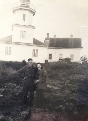
Today, his diaries provide a view back to a simpler time when one had to be independent, resourceful, and dedicated to keeping the light burning bright. Dick and his family managed to survive on this rocky point because of their livestock. The family maintained a chicken coup and one diary entry references 23 chickens killed by a weasel one night. The following night, the entry stated the weasel had had its last supper. That night, weasel was served at the dinner table.
Canadian Lighthouses of Lake Superior (CLLS), a nonprofit charity, has leased three lighthouses on the North Shore; Porphyry, Trowbridge, and No. 10. These aids to navigation celebrate regional history through educational programs by CLLS. Recently, a public notice was made that No. 10 (Shaganash) Lighthouse will soon be owned by the charity. This light, situated a further 9 miles east of Porphyry, has been used recently by kayakers who adventure across the archipelago of islands to Rossport.
On July 1, Canada Day, there will be a celebration for the 150th anniversary of having a light station situated on Point Porphyry. Charter boats will leave the small hamlet of Silver Islet in the morning ($120 CAD per person) for a day of commemoration on the island. Local Hammarskjöld High School students will be unveiling their wooden replica of the original lighthouse. Minister of Parliament, Patty Hajdu, will be on hand to acknowledge the moment, accompanied by a historical tour, a “Painting Superior” activity by Parks Canada, and a picnic lunch.
This summer, tours continue to the island on Thursdays and Sundays from Silver Islet Harbour just behind the re-opened Silver Islet General Store. A historical tour of the lighthouse also includes an introduction to the boreal forest, arctic-alpine disjunct, and the volcanic underpinnings. It’s a day well spent, filled with panoramic views of Sleeping Giant, the clean, cold, turquoise waters of Lake Superior, and a friendly environment for discovery. The cost is $105 (CAD).
Once acclimatized to visiting a new place, one can let their imagination flow back in time to when birch bark canoes ladened with fish and wild rice travelled these waters. Visiting a lighthouse, such as the one on Porphyry Island, will give a true Lake Superior experience as there are no paved highways, just the open waters of Superior and your imagination.