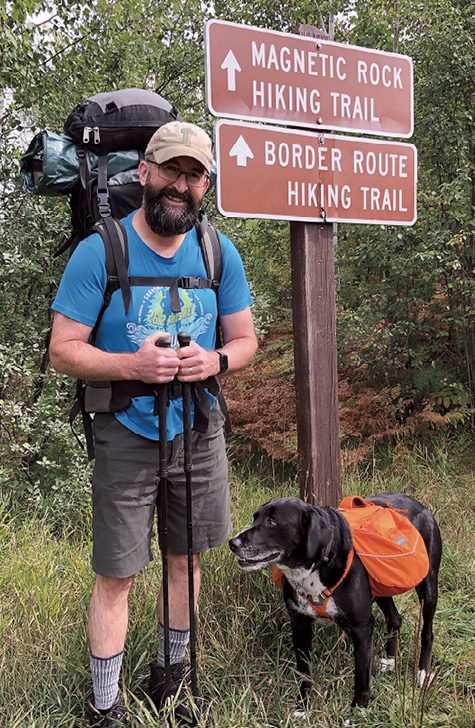
The parking lot was full on the Wednesday after Labor Day in 2020. We unloaded gear at the west trailhead to start an eastbound thru-hike of the 65-mile Border Route Trail (BRT) through the Boundary Waters Canoe Area Wilderness (BWCAW). I was already anxious since it was just me and my dog Leo. I was surprised to discover I might have trouble social distancing on a week-long solo backpacking trip. I kissed my wife Shelley goodbye and she drove 160 miles back home to Duluth. Not many people would shuttle cars for six hours. She’s awesome.
Leo trotted ahead of me wearing his own Ruffwear backpack. This was the first time he’s used a pack on a long trip. He trained with the pack so it wasn’t new. He carried his own food and a collapsible bowl for a total of 7 pounds. I was happy my trip backpack weighed only 48 pounds. I appreciated Leo’s help.
In the first hour, we saw 20 people. After a mile and a half, we arrived at the popular Magnetic Rock. It’s an impressive monolith that tweaks your compass, reminiscent of the object in the movie 2001: A Space Odyssey. Leo and I were relieved to shake the crowds after that point.
Since we spent the morning shuttling cars, this was a short day. We skirted the cliffs near Gunflint Lodge and followed the north shore of Loon Lake to the campsite. I pumped water through my filter as the setting sun cast a rainbow to the east. Leo sat there like a pot of gold. We drifted to sleep while some barred owls asked us, “Who cooks for you? Who cooks for you-all?”
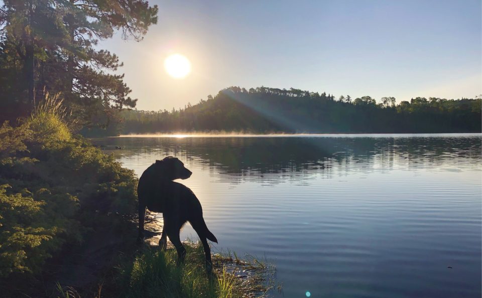
The sunrise was dreamlike. The green hills cradled the sun at the east end of the long, narrow lake. It was silent and the mist drifted off the water. We ate our breakfast on the shore of Loon Lake while two loons floated by, of course.
We looked north over Gunflint Lake from open ledges. The trail got brushy for the next several hours. I used my Leki trekking poles like a snowplow and leaned into the head high bushes that filled the trail. During this stretch, we saw the sign for Bridal Falls. After a sharp descent, we found the unique waterfall. It’s a long rectangular ledge where water spills out intermittently over the slate-like rock.
The brush eased up and we crossed the border into the BWCAW. We called it a day at the scenic Topper Lake campsite. We napped in the sun on a flat ledge by the water. As we basked, my Biolite solar panel charged my mobile phone and my Garmin Forerunner 35 GPS watch. This system kept my devices fully charged all week.
The third day broke with another beautiful sunrise over the mirror of Topper Lake. We hiked east through majestic red pine stands near South Lake. Suddenly, there was a window of blue sky to the north. We stepped up and got our first look at the highlight of the week: the Rose Lake Cliffs. After that teaser, we found the magnificent views from the top. The sea of green is split by the narrow river-like combination of Rose, Rat, and South Lake to the west.
We went downhill past more magnificent views as Rose Lake expanded to the east. Massive cliffs on Arrow Lake over in Canada stood out over four canoes that moved west over Rose Lake. Then down through another massive cedar stand to the shore. It was Friday during covid and the wilderness was busy. Both Rose Lake West and East campsites were occupied, so we took a spur off the BRT to a campsite on Daniels Lake. A great sunset capped the unexpectedly long day.
It poured nonstop for two hours before dawn on day four. There were some drizzly showers during the day, and the brush along the trail stayed wet. I got soaked, even with a rain jacket on. We found one awesome overlook of Watap Lake. Calm and quiet, even though overcast and misty. We set up at the Gogebic Lake campsite for the night.
We worked our way over and under several blowdowns on the way to John Lake on the fifth day. We exited the east end of the BWCAW to McFarland Lake. We soaked up sun at the dock there like lizards on a rock.
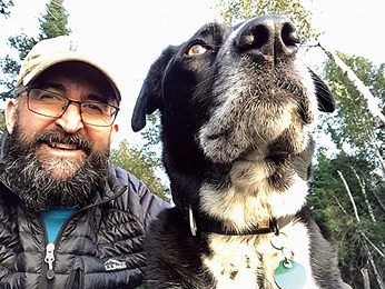
The next morning, Leo rebelled. I struggled to get the pack on him, even though it was basically empty. As I walked up the short path to leave the campground, I looked back and he wasn’t there. I hollered, “COME!” and he poked his head around some trees. We had a staredown. Finally, he very slowly moseyed up to me. After that bit of comedy, he was fine. It was a good thing that was the last day.
The sun was hazy because of smoke from fires in the western U.S. We had nice overlooks as the mist burned off over South Fowl Lake near the Pigeon River Cliffs. Finally, we found the river and Leo stopped for a drink. The Pigeon River is the international border and Canada was just 30 yards across the shallow rapids. It was fun to imagine the voyageurs passing by this very spot hundreds of years earlier on their way to the interior lakes.
The last eastern mile of the BRT was special. Leo and I ran the SHT in sections in 2014. But somehow, we missed the true northern terminus of the SHT at a spot called the 270 Degree Overlook. The northernmost mile of the SHT that we skipped back then perfectly overlaps the last eastern mile of the BRT. Our last mile of the BRT would also be our last mile of the SHT. What a weird convergence.

When Leo and I walked into the parking lot at the Otter Lake Road, three things would happen at the same time. First, we’d finish six days of backpacking the BRT. Second, we’d complete our unfinished last mile of the SHT. Third, because we hiked the Kekekabic Trail in 2018, it would mean we linked all 415 miles of the North Country National Scenic Trail in the Arrowhead. I bet there aren’t many dogs who’ve done all that. And it would all come together like a miracle on the last step. We looked over at the 270 Degree Overlook through some pines and relished the fact that this last day was the first time we hadn’t seen anybody.
We took the short spur to the 270 Degree Overlook and it got busy. Five people and several dogs occupied the small knob. Mindful of the pandemic, I stood over to the side and leashed Leo for the first time on the whole hike. After the folks left, we took some time to look over the Pigeon River as it wiggled toward Lake Superior.
We saw a dozen people on the mile to the truck. As we went downhill, I felt like an astronaut descending in a capsule surrounded by a ball of flame as we reentered the atmosphere of society. Seven cars were parked where only three would normally fit.
Several days earlier, we were bashing through the wet brush. Sure, the vistas were world class, but you paid for them with long hours in the woods. In the crowded parking lot full of people, I realized those moments on the trail weren’t boredom. They were bliss. Just my friend Leo and I, socially distanced in remote places of peace and quiet. Our backpacking was like life. The hike seemed long, but now that it was over, it seemed far too short.