While researching waterfalls 12 years ago for our first edition of Waterfalls of Minnesota’s North Shore: A Guide for Sightseers, Hikers, and Romantics, we encountered many surprises. We experienced even more when we skipped across the borders into Wisconsin and Ontario for our new book, Waterfalls of Minnesota’s North Shore & More. Following are some great waterfalls, not too far off the beaten path, that you can enjoy this spring.

Duluth Area Waterfalls
On our many trips through Duluth and on up the Shore, we didn’t realize how many waterfalls flow within that city. And, least of all, in the slim, emerald gem of a park just a few blocks southwest of the famous Glensheen mansion, Congdon Park. Five cascades meander through red canyon walls along charming Tischer Creek. What a lovely oasis in which to stretch your legs away from the hubbub of the city. Access this park at the corner of Superior St. and Congdon Park Drive. There is a dirt trail there that descends the stone steps by the bridge. Fourth Street bisects the park, so be sure not to miss the upper half across 4th Street, up to Vermillion Rd.
Wisconsin Waterfalls
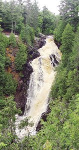
Northern Wisconsin hosts a whole world of waterfalls, many just a short jaunt away. Only 19 miles from Duluth, the Big Manitou Falls, at 165 feet, thunders in the Black River at Pattison State Park. While comparable in height to Minnesota’s High Falls of the Pigeon River, Big Manitou allows you much closer access to its 5-star torrent. The best overlook is also wheelchair accessible. And nearby Little Manitou Falls (we rated it 4 stars) is by no means “little.” From Duluth, take the I-535 S. bridge to Superior, Wisconsin, and then WI-35 S. to the park.
The Amnicon River, in Wisconsin’s Amnicon State Park, is also located about 19 miles from Duluth. Though its waterfalls are not as impressive as Big Manitou, the quarter-mile round-trip piney trail, which includes a crossing over a quaint covered bridge, is easy and leads to a river island and three main waterfalls with a drop in the 15-25 foot range. From Duluth, take the I-535 S. bridge to US-53 S/E 2nd St. in Superior, Wisconsin and follow US-53 S. 13 miles to US-2 E. and then County Road U into Amnicon State Park. If you want to get from Pattison State Park to Amnicon State Park, take County Road B east to County Road A north. Go east on County Road Z until you come to US-53 S., turn right and take US-2 to Amnicon State Park.
North Shore Waterfalls
Back in Minnesota, and heading up the Shore, who knew that Split Rock State Park was the setting not only of the magnificent lighthouse, but that Split Rock River may be the most waterfall abundant river on the whole shore, sporting a stretch of nine major waterfalls within 1.3 miles? Park at the trailhead parking lot on Hwy 61 near mile marker 46. The trail to the first waterfall, West Branch Falls—about a half mile in—is of good quality. You will come to a sign saying, “Split Rock River Crossing 1.8 miles,” where you will head right. Fifty-five steps take you down to a shaded elfin glen with a footbridge traversing a side-creek called West Branch Split Rock River. From this bridge, behold a glistening waterfall cascading 20 feet into a serene pool. This is a destination, in itself, but you can continue on the main trail. The trail transitions to fair and poor, but leads past many more waterfalls, which are easiest to view before the leaves sprout. The last of the major falls occurs about 2 miles from where you began at the highway. Come back the way you came or cross the bridge to return, though you will rejoin Hwy 61 about .3 miles up the highway from your car.

Continuing north on 61 (mile marker 50), you’ll encounter the town of Beaver Bay. Most people driving through don’t even realize there is a 5-star Minnesota waterfall visible from the Highway 61 bridge walkway, thundering just beyond the highway. Beaver River borders the east edge of “downtown” Beaver Bay. Park in the wayside just west of the Beaver River Bridge. A short hike across the parking lot and onto the bridge is all it takes to get a gander at spectacular Beaver River Falls.
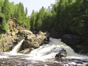
While the High Falls of the Baptism River, in Tettegouche State Park (mile marker 58), gets all the attention as the highest waterfall in Minnesota (and it is definitely worth the visit), The Cascades of the Baptism River is one of our favorites on the Shore. Check out the park map for detailed directions to both. The Cascades seem to come out of nowhere as the Baptism River drops about twelve feet like a natural waterslide. Sitting at water level provides an inspiring view, and rushing whitewater drowns out every other sound. Sit a spell, soak your feet, and enjoy its music.
For those who yearn for a more rugged and out-of-the-way experience (but not super rugged or we wouldn’t have attempted it), we highly recommend The Cascades of the Manitou River in Crosby-Manitou State Park. This hike has a lot of ups and downs—stairs and inclines—and is about 2.3 miles round-trip. Leave Highway 61 (mile marker 49+) and drive 6.5 miles up Highway 1 to where it intersects Country Road 7 in Finland. Take a right and continue 7.5 miles to the entrance of the state park. Pick up a park map at the informational display board and continue to the trailheads where you will set off on Middle Trail, which is part of the Superior Hiking Trail. This 4-star waterfall is another of our very favorites. It is composed of three parts, which together drop 40 or 50 feet along a 150-foot stretch of river. The upper section pours through a narrow gorge and onto a broader, middle tier comprised of multiple falls to the lowest tier where it splits in two. But if you visit in the spring, the tiers pretty much disappear into one lawless deluge.
For a great place to stretch your legs (and then some) make a stop at 40-foot Caribou Falls in Caribou Falls State Park (we rate it 4 stars) (mile marker 70). This 1-mile round-trip hike has its difficult stretches—mainly the 150-plus steps down to the waterfall. But in times of high water—like now—there may be no beach from which to access the base of the waterfall. In that case, content yourself with the views from the stairway and try to be happy you don’t have quite as many steps to climb on the way back.
Onion River Falls was pretty much unknown before the Ray Berglund Memorial Wayside (mile marker 86) was improved, and the marginal angler trail to the river transformed. The .8 mile round trip hike offers majestic views of the river valley, its waterfalls, and Lake Superior floating on the horizon.
Lovely Cascade Falls in Cascade River State Park (mile marker 100) is a well-known and often photographed Minnesota waterfall of the North Shore, emerging from a narrow black gorge to pound 25 feet into a rounded hole surrounded by a verdant green evergreen forest. The easy 2-minute hike is always worth the small effort. No matter how many times you may have seen the waterfall before, depending on the time of year and the time of day, it may look like a totally different animal. Snap a selfie and share the scenery.
If you’ve ventured north of Grand Marais, you may have noticed the sign for the Kadunce River (mile marker 118). What you may not have known is that the river affords an interesting hike (a spur trail for the Superior Hiking Trail), sometimes at river level and sometimes above it, with various waterfalls tumbling along its length. It’s about a mile up to Kadunce Bridge and, at times, the canyon becomes so narrow and deep that you cannot see the river at its bottom.
Canada Waterfall
Most people visiting the North Shore might not even consider a day trip into Canada, but if you like waterfalls, you should. Especially since Kakabeka Falls, a.k.a. The Niagara of the North, on the Kaministiquia River in Kakabeka Falls Provincial Park is just 80 miles from Grand Marais. This waterfall is 131 feet high (just 39 feet shorter than Niagara) and spans 213 feet. Its magnificence is magnified by the romantic legend of the brave Ojibwe princess, Green Mantle, and the Sioux warriors who pursued her. You may even hear the spectral echoes of their angry shouts and see her lovely spirit lingering in the rainbows at the base of this mighty waterfall. Continue north on Hwy 61 to Thunder Bay, then head west on Highway 11/17 for about 17 miles to the park.
