Did you know that out of more than 250,000 rivers in the United States, the two longest are the Missouri River at 2,341 miles (3,767 km) and the Mississippi River at 2,340 miles (3,766 km)? Did you know the 370-mile-long (595 km) Minnesota River is a tributary of the Mississippi River? It’s also the namesake for the State of Minnesota, the name coming from the Dakota language “Mnisota Makoce” which was translated to “land where the waters reflect the sky.” Other sources list Dakota variants as the source like, “mini sota” meaning “clear blue water,” or “Minissota,” translated to “cloudy water.”
In Canada, according to Canadian Geographic, the country has 8,500 named rivers, with the two longest being the Mackenzie River at 2,365 miles (4,241 km) and the Yukon River at 1,979 miles (3,185 km). In Ontario, the longest river is the Ottawa River at 790 miles (1,271 km).
While there is some ongoing debate about what qualifies as a river versus a stream, and how a river’s length is measured (like where does it really begin and end?), the world of pop culture and arts like the romanticism and adventure surrounding rivers, using it in the title of many songs and movies. Who hasn’t heard of the classic Moon River (Andy Williams); The River (Bruce Spingsteen); Down by the River (Neil Young); River of Dreams (Billy Joel); Cry Me a River (Justin Timberlake) and River (Joni Mitchell), to name a few. Movie titles include Wind River; River; The River is Wild; A River Runs Through It, and from almost a century ago, Gene Autry’s Red River Valley.
In our Northern Wilds region, we’ve got plenty of rivers. Here’s a snapshot look at just a few of them.
For starters, Thunder Bay has two major and historic waterways flowing into Lake Superior. Over in the south end (aka the former city of Fort William), there’s the Kaministiquia River, which locals simply call the “Kam,” and in the northern side (aka formerly Port Arthur), there’s the Current River.
According to the late historian J. B. Bertrand in his book Highway of Destiny, “The interpretation of the word Kaministiquia from its original Ojibway language is ‘meandering river’ and ‘a river with three mouths.’” The description is very apt, as at the mouth of the river is a delta with two islands, McKellar Island and Mission Island, and three distinct branches flowing into Lake Superior. The southern channel is Mission River, the central outlet is McKellar River, and the northernmost branch is the Kaministiquia, flowing 59 miles (95 km) from its source at Dog Lake.
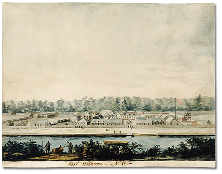
The historic Kam River was a major fur-trade route to western Canada. Today, further down the Kam, is one of the world’s largest reconstructed fur-trading posts, the North West Company’s (NWC) inland headquarters now known as Fort William Historical Park. The original dated back to the early 1800s and was situated at the mouth of the Kam River (the first post on the Kam was built in 1684-85 by Duluth’s namesake Daniel Greysolon, Sieur du Luht).
On the Kaministiquia is Ontario’s second largest waterfall, Kakabeka Falls. Also known as the “Niagara of the North,” it drops 154 feet (47 metres) into the river. An accessible boardwalk trail on both sides of the river brings visitors up close to the falls.
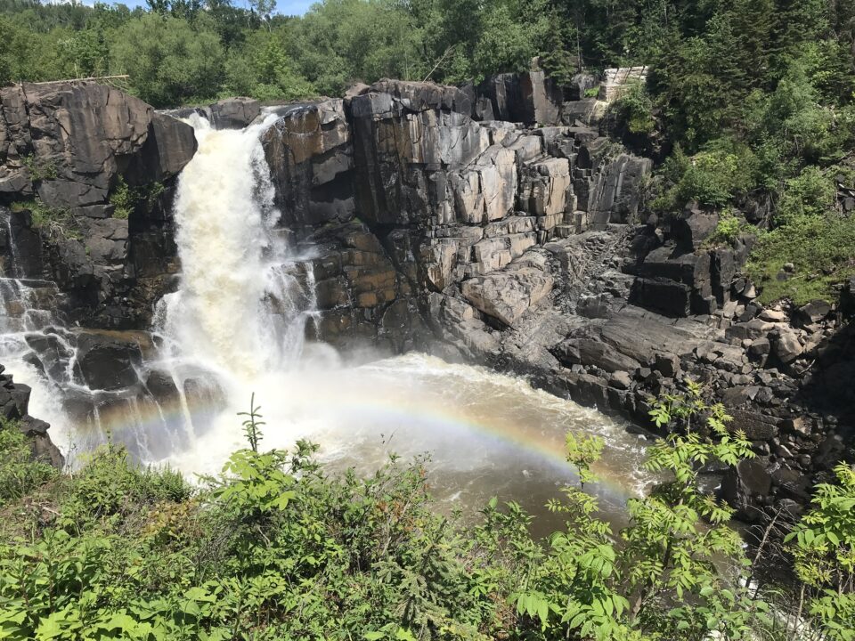
A second important waterway for fur-trade and transportation to the Canadian West was the Pigeon River, which flows easterly from the Boundary Waters Canoe Area Wilderness for 31.2 miles (50.2 km) and empties into Lake Superior at Grand Portage (site of the first NWC inland fur-trade headquarters; today visitors can explore a reconstructed fort at the Grand Portage National Monument). A few miles before the Pigeon River enters Lake Superior is Minnesota’s highest waterfall, High Falls in Grand Portage, which drops 120 feet (37 metres) into the river. A short 1.1-mile (1.9 km) paved boardwalk trail leads visitors to the falls from the visitor centre.
Pigeon River—namesake for the extinct passenger pigeons which once numbered in the millions—is the English translation of the 18th century French name Rivière aux Tourtres or Tourtes. However, back in the late 1600s, its first European name was St. Pierre River (St. Peter in English) because it was ‘found’ on St. Pierre Day by a French group that included people named “Pierre.”
Pigeon River forms part of the Minnesota-Ontario border. During the Covid-19 pandemic when the international border was closed, there are tales of friends happily ‘meeting’ and talking across the river—friends standing on the Canadian side and Americans on the other.
One short river in Minnesota’s Boundary Waters seems at first to have a baffling name—Crocodile River originating in Crocodile Lake. Crocodiles in Minnesota? As the story goes, the name comes from the crocodile shape of the lake and the Crocodile River forms the tail.
The name Knife River begs the question, what does the waterway have to do with a knife? Well, none. In the Minnesota Geographic Names and Their Origin and Historic Significance (1920), Warren Upham writes that the Knife River’s name is an “accurate preservation of its native Ojibwe name Mookomani-Ziibi” and that it was “probably given on account of the long, sharp stones near the mouth of the river.”
