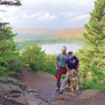
The Superior Hiking Trail is named after Lake Superior, but could easily earn that name because of how high the trail ranks among hikers.
“Our trailheads are overflowing on weekends right now,” said Jaron Cramer, development and communications director at the Superior Hiking Trail Association. “It has been inching toward that in recent years, but the increased use this year with COVID-19 is noticeable.
“Now more than ever, we know how important trails like this are, getting out into the woods and moving your body, getting those moments of awe,” Cramer said.
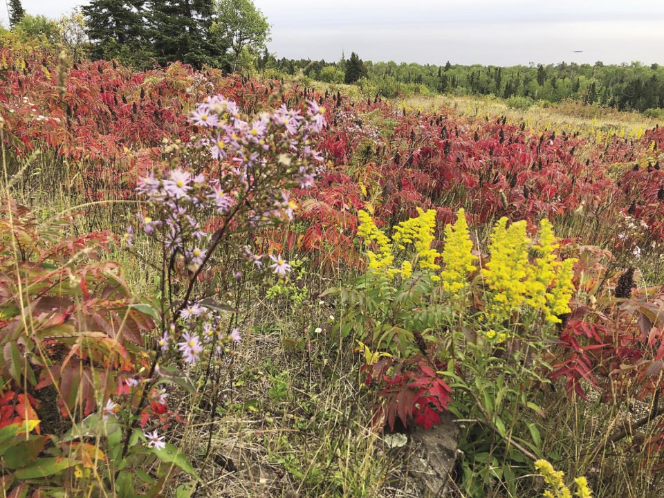
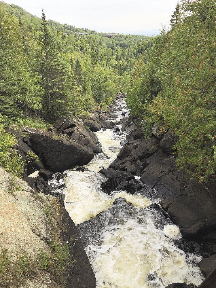
The trail offers plenty of opportunities for awe: 300 miles of river cascades, waterfalls, wildlife, and panoramic views of Lake Superior. In October, the forest along the trail reaches its peak fall color change. “The last week of September, this 3-4 week window starts when the maples, oak, and aspen turn. The palette of the landscape starts to pop,” Cramer said.
The trail offers a full gamut of hiking experiences from 1-2-hour day hikes with beautiful views, to section hiking for the weekend, to living a full month on trail while hiking the entire 300-miles, known as thru-hiking. The trail association estimates 50,000-100,000 people hike the trail every year. In 2019, the trail officially became part of the North Country National Scenic Trail, which runs 4,600 miles from North Dakota to Vermont.
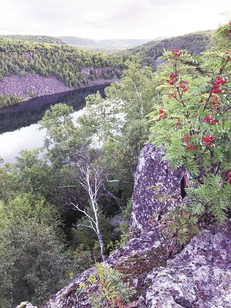
Stretching from the Wisconsin state border to the Canadian border, at its southern end, the trail runs through Duluth, routing through forested city parks that feel almost as wild as the forest further north. Between Duluth and Two Harbors is the flattest topography of the trail, but once the trail reaches Castle Danger, it starts running the ridges of the North Shore Highlands, 1.1 billion years old, according to the U.S. Forest Service.
The trail visits each state park along the North Shore, and crosses into the Sawtooth Mountains at Carlton Peak, passing by Britton Peak, Oberg Mountain, Leveaux Mountain and many more before reaching Grand Marais. Over the length of the trail, the elevation changes about 41,000 feet, according to the trail association. This year, hikers can participate in the 2020 Summit Challenge of hiking seven of the trail’s many peaks by October 31.
North of Grand Marais the terrain offers some of the best river gorge and waterfall territory, as well as a close-up look at how dramatically beavers can impact a forest. The trail ends at the 270 Degree Overlook of the Canadian border.
In his new book The Superior Hiking Trail Story, Rudi Hargesheimer explains how the trail was dreamed into existence by a coalition of people.
U.S. Forest Service Rangers based out of Tofte built a previous “Superior Trail” in 1980, which ran from Britton Peak to Oberg Mountain and now forms part of the current route. Those rangers dreamed of extending the trail along the entire North Shore. State Park employees, local residents, North Shore resort owners and Minnesota DNR park administrators were also dreaming of building a trail along the shore, but navigating the different land management jurisdictions proved difficult.
Tofte ranger Leland Schaar enrolled in Clemson University Recreation Short Course and “did a research paper on how to model it after the Appalachian Trail—to get different jurisdictions to work together,” Hargesheimer said. “John Chell loved it. He worked for the DNR as the regional parks administrator out of Grand Rapids. He, more than anyone, pushed for it.”
Chell brought all the groups together at Bluefin Bay in January 1986 and they drafted Tom Peterson to design the route; he’d just finished building the North Shore State Trail and knew the land.
“Tom sat down with just topographic maps, no computers. He’d make check marks, saying ‘This might be a good overlook. We need to connect those two dots.’ He’d go out in the woods with a compass, pink ribbon and just do it. The original 205-mile route was 90 percent his effort. You could call him the father of the trail,” Hargesheimer said.
Hargesheimer was a member of the trail association’s board and its president much of the time Peterson was making his reports on the trail’s progress.
“He’d been out by Jackson Lake and he came to the board and said, ‘I think we’ve gone to the highest point of the trail.’ I went out the next day and hiked it, following the pink flags. The top of Rosebush Ridge was a tangle of thorn bushes. It was a hot humid day and I only had running shorts on. I was pushing through those bushes and got totally ripped up. I was a bloody mess at the end.
“Later, when we made the first whole trail map, I named it Rosebush Ridge. Ha! All those thorns up there turned out to be raspberries,” Hargesheimer said.
For 30 years, staff and volunteers scouted, bushwhacked, sawed, and grubbed the trail into existence, some volunteering 60-70 hours a week like the famed Ken Oelkers, until completing the final two miles to the Wisconsin border in 2017.
“In the 1980s, backpacking was a pretty minor sport in Minnesota,” Hargesheimer said. “The Border Route Trail was built, and Crosby Manitou State Park existed, but that was pretty much it. The Kekekabic Trail was overgrown. When they built the Superior Hiking Trail, it added a lot more miles to the mix.”
Day hikers fell in love with the trail first. With trailheads every 3-11 miles, hopping on and off the trail for day trips is easy. “It’s popularity grew leaps and bounds mostly from the day hikers, but the people who want to thru-hike the whole thing, of course that became a big deal,” Hargesheimer said.
Descending into the Devil’s Track River gorge in the pouring rain in 2019, Jon “Yea-Yea” Banker, 25, of Omaha, Neb. had one of his toughest and most valuable thru-hiking moments. “It was really hard getting down into the gorge; it was really steep and slick. But when I got down into the gorge, it was stunning. The red rock was incredible, and the flow of the river is so strong,” Banker said.
Banker set up his tent at a campsite on the Devil’s Track River, but placed it poorly for the rain, he said. His tent collapsed during the night under the heavy rain. “Everything got soaked. But when I woke up, the sun was shining, and it was so gorgeous. That day taught me that even when things suck, you can persevere and still have a good time. It taught me how to be a thru-hiker.”
The trail is beautiful but rugged and can surprise first-time hikers with how physically challenging the hiking can be. “Expect rocks, roots and mud,” Hargesheimer said. “Wear decent footwear.”
Cramer recommends anyone interested in doing a hike on the Superior Hiking Trail, from a day hike to a thru-hike, plan ahead and prepare well. See sidebar for more information.
“Do a little research in advance. What experience do you want to have? Then make a plan so you know what to bring, what clothes to wear, what shoes to wear, how much trail you’re really ready to bite off,” Cramer said.
“I tell everyone it is rugged, and it is beautiful, and there is something cool to see around every corner,” Banker said.
Resources
To plan your hike on the Superior Hiking Trail, here are the best resources. Most of the maps, books and guides mentioned here are available in the associations online trail store at shop.superiorhiking.org.
Trail Guides
- Superior Hiking Trail Association website, superiorhiking.org. Start with the “Plan Your Adventure,” “Know Before You Go,” “Leave No Trace,” and “Trail Conditions” pages.
- 8th Edition of the Guide to the Superior Hiking Trail guide, $15.95
- Superior Hiking Trail Databook, $11.95
- Thru-Hike the Superior Hiking Trail, print version, $14.95
Maps
- “Trail Atlas of the Superior Hiking Trail,” available in printed and Avenza app digital formats, $24.99
- Map Series A-F: printed maps by trail section, available in printed and Avenza app digital formats, $4.99 each
- Keith Myrmel’s Superior Hiking Trail Maps, kjmyrmel.webs.com, $34.00 (only available at Myrmel’s website)
- Superior Hiking Trail Association 6-Map Set, $6 (these maps do not have the most updated route based on updated GPS mapping, but are sufficient)
History of the Trail
The Superior Hiking Trail Story by Rudi Hargesheimer
Available from the trail association’s online store and Rudi’s website (northshorephotoart.com), as well as various North Shore stores.
Thru-Hike the Superior Hiking Trail, print version, $14.95
Support the Trail
“It’s so exciting that we’re seeing more people discover the Superior Hiking Trail and enjoy it, but that means it takes more time and resources to care for it,” said Superior Hiking Trail Association development and communications director, Jaron Cramer.
“The trail didn’t just emerge on its own. It’s thanks to thousands of supporters, thousands of volunteer hours, and the collective good will, energy, care and love that helps keep it in place,” Cramer said. “I would love for people when they are out there to enjoy it, and when they’re done, take a moment to advocate for and protect our public trails and lands.”
For more information on how to volunteer or donate to the trail, visit the Superior Hiking Trail Association website, superiorhiking.org.